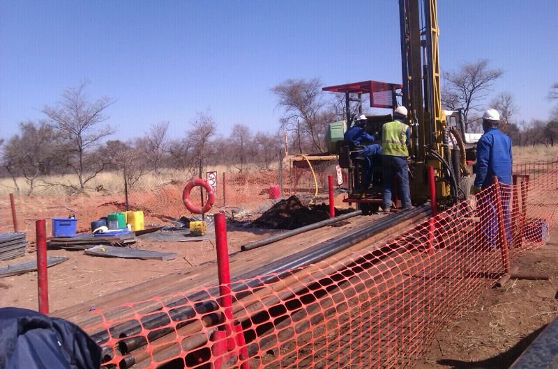
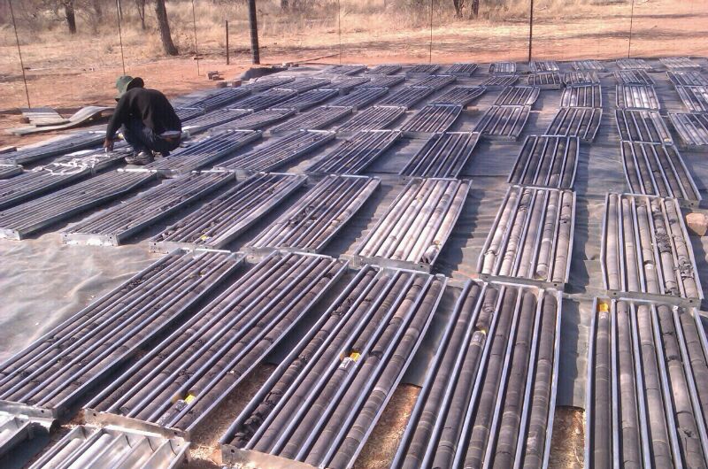
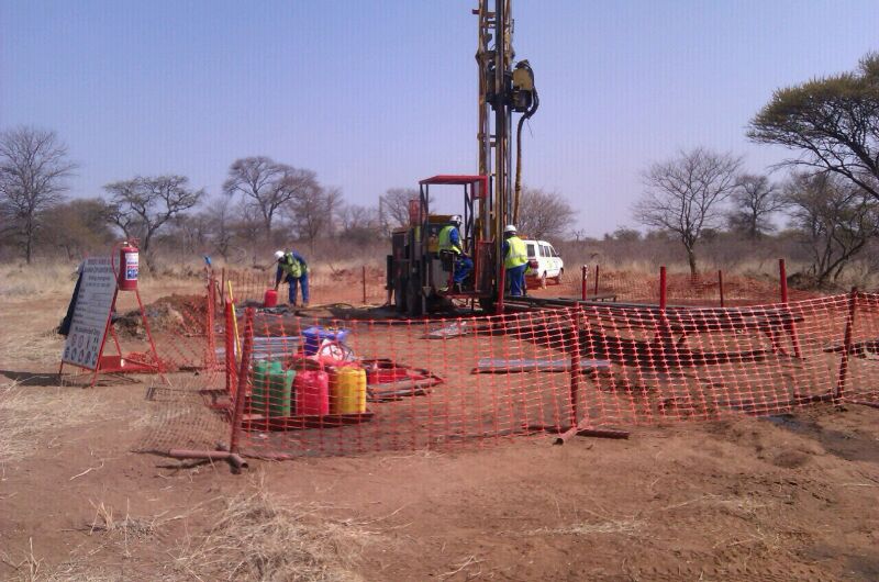
PROJECT : Filing station Development
Client: Sebadi Environmental and Social Services cc
Nature: Hydrogeological studies for Bethanie Fuel Station at Rustenburg area, Floodline studies for Luka Community Cemetry development a Rustenburg are, Hydrogeological Studies for Ha-Luka Rustenburg area.
Project Manager: Nymoki Consulting Pty Ltd
Year: 01/09/2017 - 31/12/2017
PROJECT : Mpumalanga (Driefontein, Roodepoort and Geluk)
Client:Geocoal services (Mbuyelo Group)
Project Manager: Nymoki Consulting Pty Ltd
Year: 2013-2014
PROJECT : Geology, Mining, Environment, Survey, Metallurgy
Client:University of South Africa
Project Manager: Nymoki Consulting Pty Ltd
Year:2013-2018

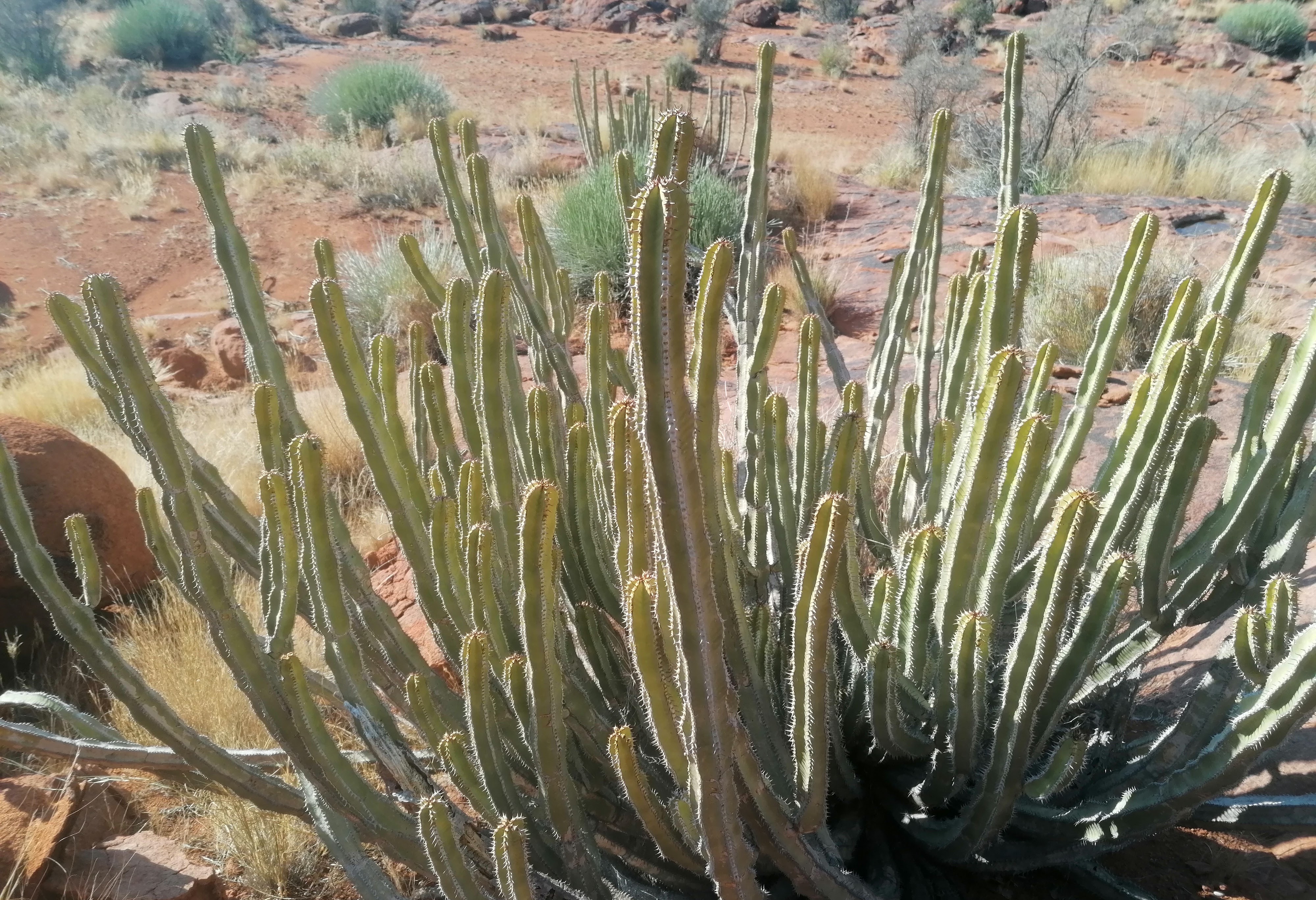
PROJECT : A study of metals dispersion from the magnesite dumps towards immediate community of Folovhodwe Village, Limpopo Province
Nature: Academic research
Project Manager: Nymoki Consulting Pty Ltd
Year: 2015 - Current

PROJECT : Environmental Impact assessment on Gas Tank Gauteng province for Bp Masana
Nature: Inspection and report writing.
Project Manager: Sivhungwana Environmental Solution and Nyamoki consulting Pty Ltd.
Year: 2015-2016

PROJECT : Geotechnical asessment for Graspan Coal Project for Design of Box Cut and Hydrological studies for storm water and water balance
Client: Tshifcor Investment and Resources
Project Manager: Nyamoki consulting Pty Ltd.
Year: 01/04/2017-31/05/2017

PROJECT : Filling station Development
Client: Sebadi Environmental and Social Services cc
Nature: Hydrogeological Studies for Bethanie Fuel Station at Rustenburg area, floodline studies for Luka Community Cemetry development at Rustenburg area. Hydrogeological Studies for Ha-Luka Rustenburg area.
Project Manager: Nyamoki consulting Pty Ltd.
Year: 01/09/2017-31/12/2017

PROJECT : Ten Flag Recreational services cc
Client: NDI Geological Services
Nature: Traffic Assessment Report and Noise Impact Study for Karussel (Ten Flag Recreational services).
Project Manager: Nyamoki consulting Pty Ltd.
Year: 01/09/2018-31/09/2018
PROJECT : Sand Mining and Granite Aggregates
Client: NDI Geological Services
Nature: Specialist Studies Steinkopf Town (Northern Cape); Hydrogeological, Wetlands, Biodiversity, Floodline, and Traffic Impact Assessment.
Project Manager: Nyamoki consulting Pty Ltd.
Year: 01/04/2018-31/04/2018
PROJECT : Andalusite Mining
Client: NDI Geological Services
Nature: Specialist studies for Pella (Pofadder Town in Northern Cape); Hydrogeological, Wetlands, Biodiversity, Floodline, and Traffic Impact Assessment.
Project Manager: Nyamoki consulting Pty Ltd.
Year: 01/05/2018-31/05/2018
PROJECT : Alluvial Diamond Mining
Client: NDI Geological Services
Nature: Specialist Studies for Avoca (Douglas in Northern Cape); Hydrogeological, Wetlands, Biodiversity, Floodline, and Traffic Impact Assessment.
Project Manager: Nyamoki consulting Pty Ltd
Year: 01/04/2018-31/04/2018
PROJECT : Diamond Mining
Client: NDI Geological Services
Nature: Specialist Studies for Kareevlei Mining Pty Ltd (Northern Cape); Hydrogeological, Wetlands, Biodiversity, Floodline and Traffic Impact Asessment.00
Project Manager: Nyamoki consulting Pty Ltd
Year: 01/05/20219-31/05/2019
PROJECT :Filling Station Development
Client: Namerc Fuel
Nature:Geotechnical Investigation Mebaskrall
Project Manager: Nyamoki consulting Pty Ltd
Year: 01/06/2019-31/06/2019
PROJECT :Filling Station Development
Client: Namerc Fuel
Nature:Geotechnical Investigation Lekoko Filling Station
Project Manager: Nyamoki consulting Pty Ltd
Year: 01/05/2019-31/06/2019

PROJECT : Coal Mine at KZN
Client: Tshifcor Investment and Resources Pty Ltd
Nature:Traffic Investment Assessment
Project Manager: Nyamoki consulting Pty Ltd
Year: 05/06/2020-31/11/2020
PROJECT : Mining Right Application
Client: Royal Bafokeng Administration
Nature:Specialist Sttudies for Geohydrology, Hydrological and Floodline study, Wetlands and aquatic assessment, Biodiversity study, heritage Study, Noise study, Traffic impact study, Mine Closure and Rehabilitation, Blasting and study, Hydropedology and soil and land capability study, civil designs and storm water management plans.
Project Manager: Nyamoki consulting Pty Ltd
Year: 01/02/2020-Current

PROJECT : Filling Station Development
Client: Namerec Fuel
Nature: Geotechnical Investigation, Floodline Study, Heritage Study for Filling station at Vhufulwi community
Project Manager: Nyamoki consulting Pty Ltd
Year: 02/02/2019-Current

PROSPECTING RIGHT AND ENVIRONMENTAL AUTHORISATION APPLICATION FOR, ANDALUSITE, RESOURCE ON THE FARM HOOGGENOEG 293 KS WITHIN THE LEPELLE-NKUMPI MAGISTERIAL DISTRICT, LIMPOPO PROVINCE
PROJECT DESCRIPTION
The andalusite deposits were previously being mined through an opencast method, using both face development and bench-mining procedures. Generally, mining consists in the removal of overburden, which is basically a bulldozer-loader-trucking operation. Currently, the Hooggenoeg Andalusite Mine is not operating since 1962 hence; Mamiane Development and Enterprise permit area is currently occupied by stockpiles (previously mined out) of waste materials ranging from 60 m high reducing the space require exploring further the andalusite minerals. Mamiane Development Enterprise aim to reclaim those waste materials of andalusite to recover the remaining andalusite minerals and further sell the slug to the cement companies (after dried) in order to reduce the current environmental challenges of those waste andalusite materials. It must be noted that only the waste rocks and topsoil will be stored onsite. Andalusite mineral is used in the manufacture of refractory finished products such as bricks, castables and monolithic shapes, mainly for the iron and steel industries. It is also used in the aluminium, cement, foundry, insulation and petrochemical industries
Processing of the andalusite waste rock materials will require a screening plant, trucks, front-end loaders and crushers. Andalusite waste materials will be loaded and hauled to the crushing and screening plant and crushed to less than 25 mm. The crushed material is then de-slimed in the washing plant to remove the <0>
PROJECT : Chrome Mining
Client: DTMM
Nature: Chrome and quartz exploration
Project Manager: Nyamoki consulting Pty Ltd
Year: 07/07/2020-Current

PHASE 1 HERITAGE IMPACT ASSESSMENT FOR MINING RIGHT APPLICATION FOR THE OPEN PIT AND UNDERGROUND MINING LG6/6A AND MG1CHROMITE MINERAL RESOURCES ON FARMS BOEKENHOUTFONTEIN 260-JQ, BEERFONTEIN 263-JQ AND TURFFONTEIN 262-JQ NEAR PHOKENG, NORTH WEST PROVINCE.
PROJECT DESCRIPTION
This report serves to inform and guide the developer and contractors about the possible impacts that the proposed mining right development may have on heritage resources (if any) located in the study area. In the same light, the document must also inform the South African Heritage Resources Agency (SAHRA) about the presence, absence, and significance of heritage resources located in the study area. As required by South African heritage legislation, a development exceeding 5ha such as this requires pre-development archaeology and Heritage assessment by a competent heritage practitioner to identify record and if necessary, salvage the irreplaceable heritage resources that may be impacted upon by the proposed Mining Right Application. In compliance with these laws, Sebadi Environmental and Social Services cc appointed Integrated Specialist Services (Pty) Ltd (ISS) to conduct a Phase 1 Archaeological and Heritage Impact Assessment (AIA/HIA) of the proposed mining development. Desktop studies, drive-throughs, and field walking were conducted to identity heritage landmarks within the Mining Right Application site
The study site is not on the pristine ground, having seen significant transformations owing to agriculture, powerlines, railway line, residential development, mining, and road works (see Figure 1). The Royal Bafokeng Nation land is known for its historical and Late Iron Age occurrences (Siyathembana 2013). The sites were extensively researched by several archaeologists such as Kusel (2003), Pelser (2007), and several others. In terms of the built environment of the Mining Right Application site one farmhouse was recorded within the Mining Right Application site but not directly on the position of the open pits. Besides, sub-surface archaeological material and unmarked graves may still exist and when encountered during construction, work must be stopped forth-with and the finds must be reported to the SAHRA or the heritage practitioner. This report must also be submitted to the SAHRA for review.

Wetland Delineation and Impact Assessment study in support Of the Prospecting Right Application for Grasdrif Diamond Mine
EXECUTIVE SUMMARY
1. BACKGROUND
Nyamoki Consulting (Pty) Ltd has been appointed by Nabas Diamonds (Pty) Ltd to conduct a wetland delineation and Impact Assessment in in support of the Prospecting Right Application For Grasdrift Diamond Mine In Grasdrif, Richtersveld Local Municipality, In The Namaqua District Of The Northern Cape Province. The investigation has been undertaken to form part of the Environmental Impact assessment (EIA), Water Use Licence Application and associated management plan (EMP).
2. LOCATION
The project location is approximately 140 km northeast of Alexander Bay within the Richtersveld Local Municipality, in the Namaqua District in the Northern Cape Province (Figure 1). The site covers an estimated area of 2691,1942 hectares in extent and the geographic coordinates are 28° 25' 35.67" S & 17° 23' 1.69" E (-28.426575, 17.388028) with an altitude of 152, 832 metres above sea level.

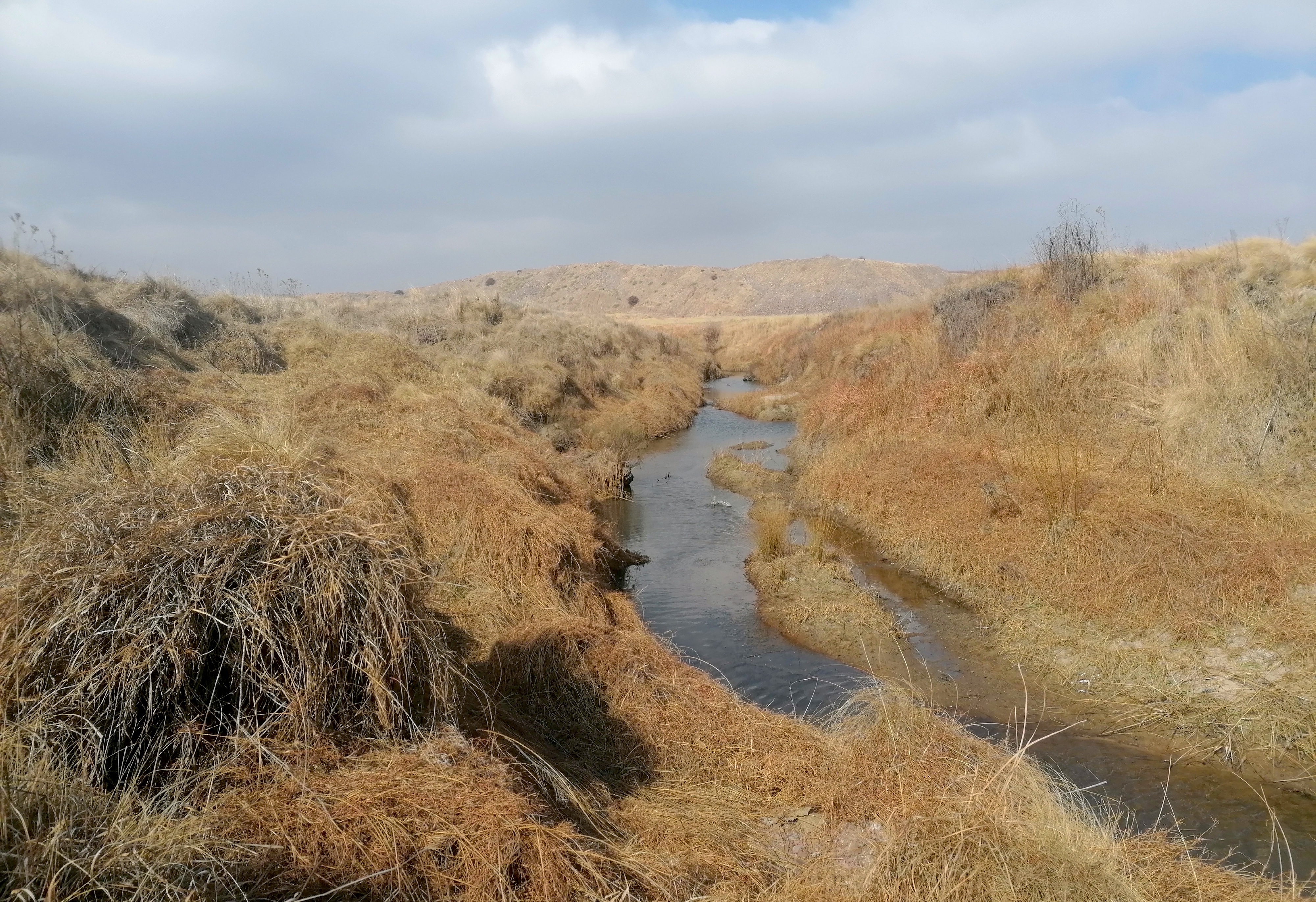
3. WETLAND DELINEATION
The proposed project is located within 500m of a watercourse, specifically the orange river, Oudannisiep river, a number of tributaries that drain into the orange river and a few wetland types ( Flat, Channelled Valley Bottom Wetland and Floodplain Wetland) (Figure 2). it is important to note that the watercourses are recognised as a National Freshwater Priority Area by the SANBI. It can be classified as a Major River with associated tributaries and a few wetlands types (Flat, Channelled Valley Bottom Wetland and Floodplain Wetland) (FEPA) that receives surface water input based on its hydro-geomorphic characteristics. A 50m buffer has been allocated.

4. CONCLUSION
The ecological significance of the watercourses should be viewed in the context of the overall level of functionality of the catchment, which includes an important conservation area in the Lower Orange WMA. The Grasdrif Diamond Mine is located within an area that is regarded as sensitive from a wetland point of view, and thus extra caution is required at every phase of the project. It is important to note that Wetlands are also protected under the National Water Act, and the Act makes no distinction between degraded and non- degraded wetlands in terms of their importance. As a result, the relevant legal requirements should be adhered to, and the relevant stakeholders involved in the project. All invasive alien vegetation on the property must be removed and eradicated.
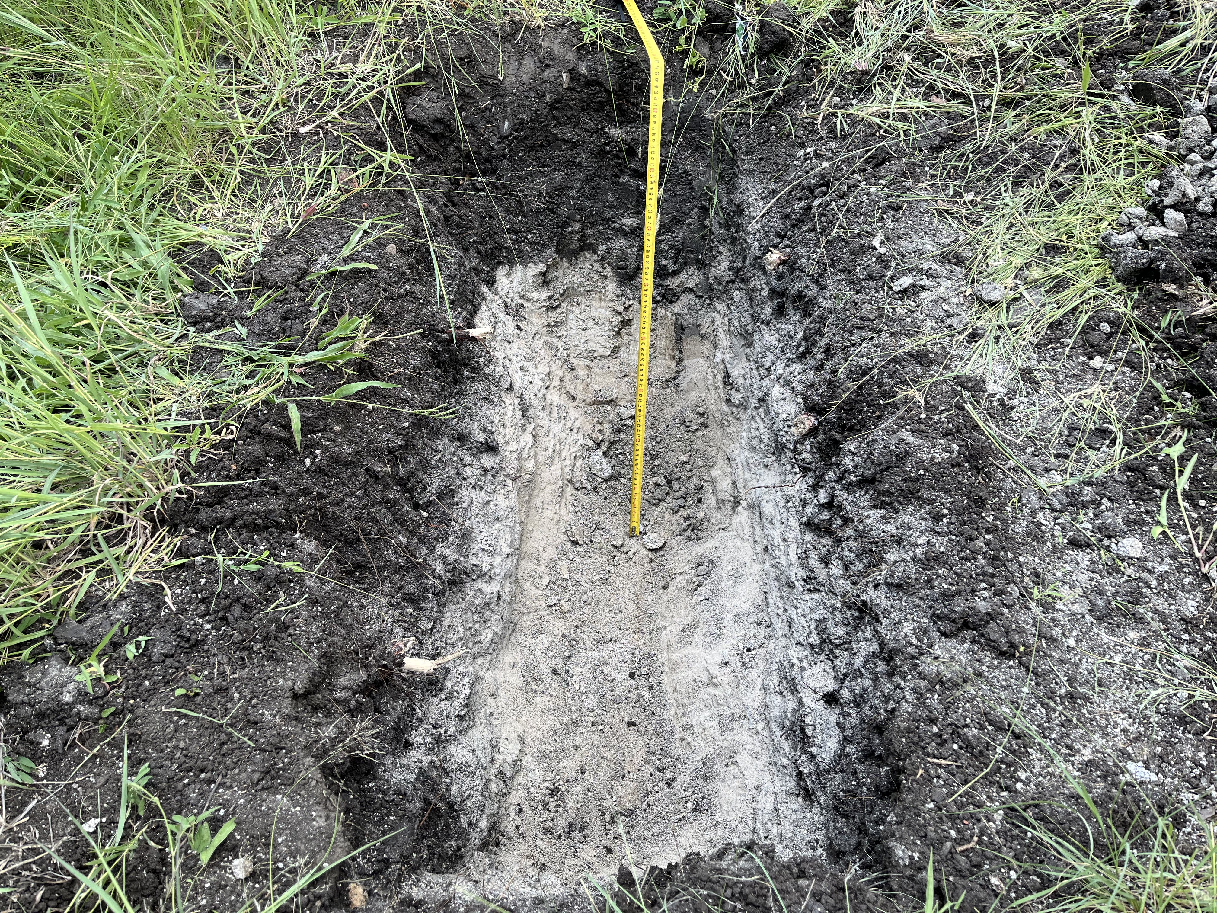
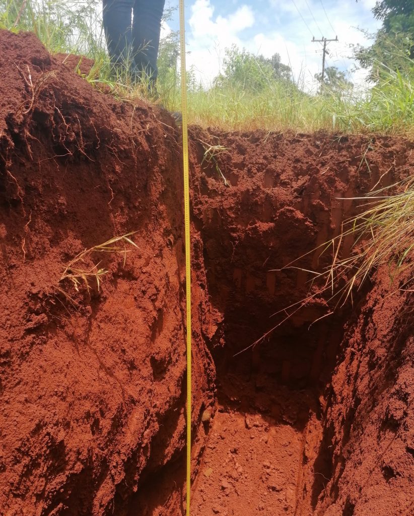
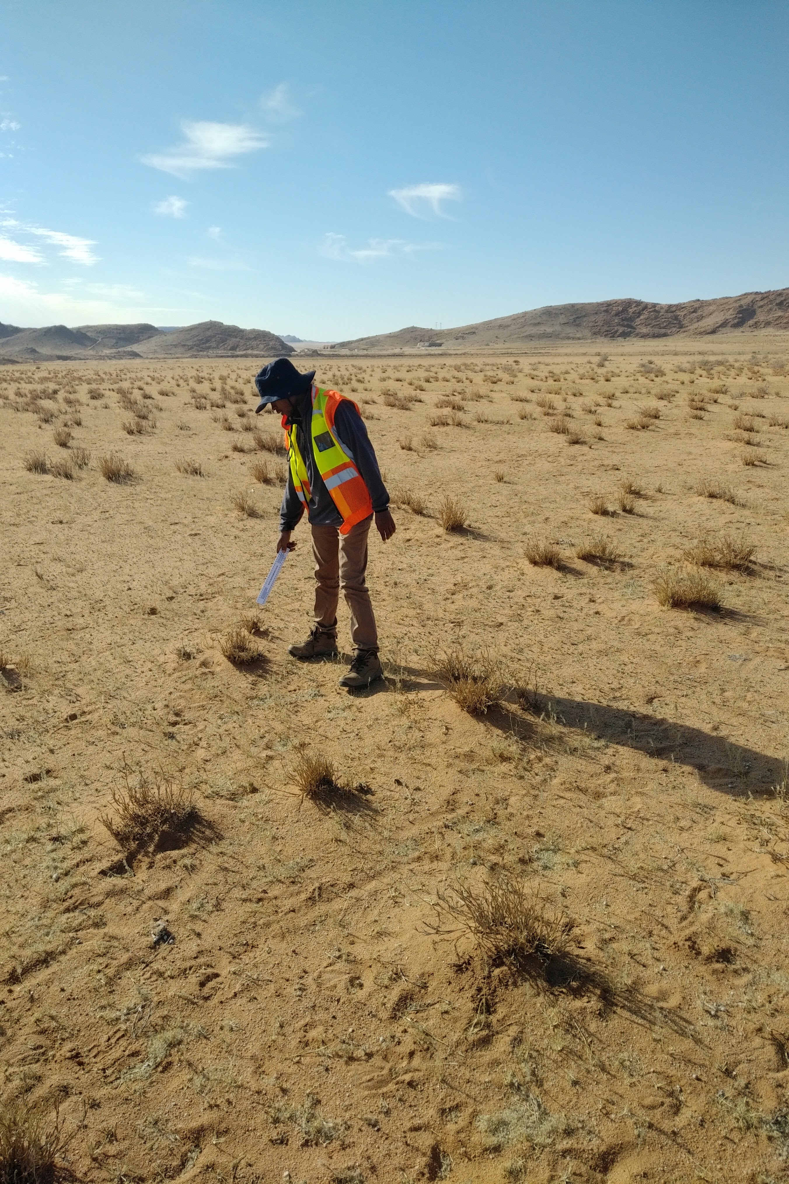
SHALLOW GEOTECHNICAL INVESTIGATION FOR PROPOSED HIGH MAST LIGHTING, RUSTENBURG LOCAL MUNICIPALITY (NORTH WEST PROVINCE)
PROJECT DESCRIPTION
1. INTRODUCTION
1.1. Preamble
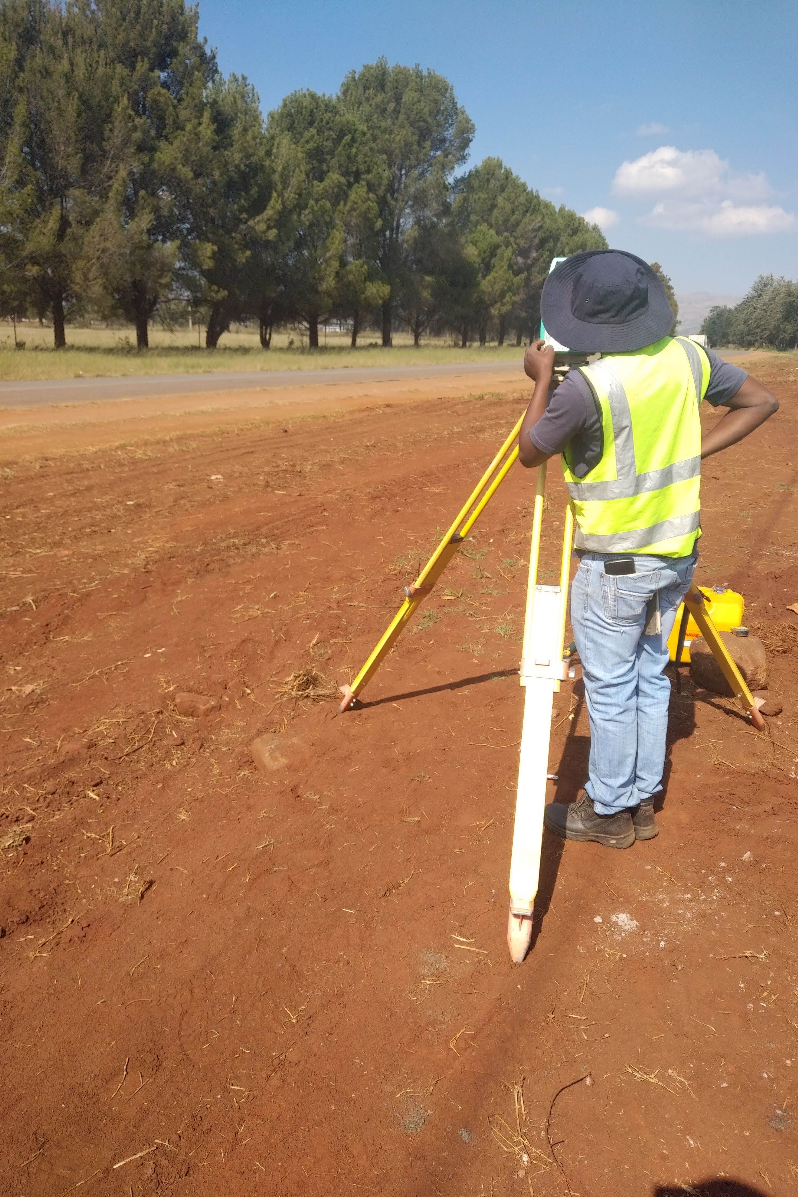
Nyamoki Consulting was appointed by Hoxana Consulting Engineers to conduct a near-surface geotechnical investigation for proposed high mast lighting in Rustenburg, North West Province.
This report provides a summary and overview of the field conditions encountered in the trial pits advanced for the investigation and the results of the laboratory testing completed on samples of the sub-grade soils collected.
1.2. Available Information
Available information includes the following:
• A kml file with proposed test pit positions (RUSTENBURG COORDINATES – 23112021)
.
1.3. Objectives
The primary objective of the investigation was aimed to determine the properties of the in-situ materials for the proposed development through test pitting. The materials intersected in the trial pits were sampled for laboratory testing.
The investigation was also aimed at supplying information in terms of:
• To determine the engineering properties of the in-situ subsoil materials for design purposes.
• To determine the nature, depth and extend of the soil underlying the site.
• To identify any other geotechnical aspect that may be relevant to the construction or engineering design.
• To assess the excavability of materials encountered on site and classify these according to the SANS1200 (SABS1200).

Mining Permit for Coal on portion of Portion 32 of the Farm Blesboklaagte 296 JS.
PROJECT DESCRIPTION
Mining Permit Application has been submitted for the extraction of Coal resources on the property mentioned above. The Mining Permit is situated approximately 7.82 km away from eMalahleni town, refer to figure 1 and 2 below.
Mining activities will be undertaken over a period of two (2) years. This project will entail an open cast method of excavation. The mine design will be developed according to the dimension of the applied mineral deposit within the project area, but overall mining activities will be limited to an area of 5 Ha as per mining permit requirements. The topsoil will be stockpiled elsewhere on site preferably next to the farm boundary and will be used during rehabilitation period. Once a box cut has been made, the overburden and mineral resources where necessary will be loosened by blasting. The loosened material will then be loaded onto trucks by excavators. A haul road will be situated at the side of the open cast, forming a ramp up which trucks can drive, carrying ore and waste rock. Waste rock will be piled up at the surface, near the edge of the open cast (waste dump). The waste dump will be tiered and stepped, to minimize degradation. All the activities will be guided by the project’s EMPr such that the project does not impact the environment negatively.

Blast Impact Assessment Royal Bafokeng Administration Proposed Boekenhoutfontein Chromitite Pit Project
PROJECT DESCRIPTION
Blast Management & Consulting (BM&C) was contracted as part of Environmental Impact Assessment (EIA) to perform an initial review of possible impacts with regards to blasting operations in the proposed opencast and underground mining operation. Ground vibration, air blast, fly rock and fumes are some of the aspects as a result from blasting operations. The report concentrates on ground vibration, air blast and fly rock and intend to provide information, calculations, predictions, possible influences and mitigations of blasting operations for this project.
The evaluation of effects yielded by blasting operations was evaluated over an area as wide as 3500 m from the mining area considered. The range of structures observed is typical roads (tar and gravel), low cost houses, corrugated iron structures, brick and mortar houses, boreholes and heritage sites.
The location of structures around the Pit areas is such that the charge evaluated showed possible influences due to ground vibration. The closest structures observed are the Historical Farm Building, Informal Housing, Railway Line, D513 Road, Buildings, Tower. Ground vibrations predicted for the pit area ranged between low and very high. The expected levels of ground vibration for some of these structures are high and will require specific mitigations in the way of adjusting charge mass per delay to reduce the levels of ground vibration. Ground vibration at structures and installations other than the identified problematic structures is well below any specific concern for inducing damage. The nearest public houses are located 48 m from the pit boundary. Ground vibration level predicted at this building where people may be present is 1287.3 mm/s for the maximum charge. In view of this specific mitigations will be required.
Air blast predicted showed the same concerns for opencast blasting. High levels may contribute to effects such as rattling of roofs or door or windows with limited points that are expected to be damaging and others could lead to complaints. The current accepted limit on air blast is 134 dBL. Damages are only expected to occur at levels greater than 134dB. It is maintained that if stemming control is not exercised this effect could be greater with greater range of complaints or damage. The pits are located such that “free blasting” – meaning no controls on blast preparation – will not be possible. The expected levels of air blast at the nearest houses, informal settlements and structures where people may congregate between 123.0 dB and 155.4 dB.
On charges considered it is expected that air blast will be greater than 134 dB at a distance of 580 m and closer to pit boundary. The structures inside the Pit area are expected to be relocated and will then not be of concern as it is currently inside the pit area. Infrastructure at the pit area such as roads, heritage sites, power lines/pylons and Railway Line are present, but air blast does not have any influence on these installations.
Fly rock remains a concern for blasting operations. Based on the drilling and blasting parameters values for a possible fly rock range with a safety factor of 2 was calculated to be 447 m. The absolute minimum unsafe zone is then the 447 m. This calculation is a guideline and any distance cleared should not be less. The occurrence of fly rock can however never be 100% excluded. Best practices should be implemented at all times. The occurrence of fly rock can be mitigated but the possibility of the occurrence thereof can never be eliminated.
Specific actions will be required for the pit areas such as Mine Health and Safety Act requirements when blasting is done within 500 m from structures and mining with 100 m for structures. The Road, Railway Line, Mining Infrastructure, Graves and Boreholes falls within the 500 m range from the pit area.
Specific attention will also be required for structures and installations within the pit boundary and those located very close to the pit area – less than 500 m from the pit.
The pit areas are located such that specific concerns were identified and addressed in the report.
This concludes this investigation for the proposed Boekenhoutfontein Project. There is no reason to believe that this operation cannot continue if attention is given to the recommendations made.

IMPALA PLATINUM HOLDINGS (IMPLATS) – MARULA PLATINUM MINE: NUMERICAL GROUNDWATER IMPACT MODELLING, JUNE 2021
PROJECT DESCRIPTION
• Sixteen of the 18 boreholes that were sampled during the 2020 monitoring year are situated around the tailings dam and its return water dam. More specifically, four boreholes are situated upgradient from the tailings dam and the remaining 12 in the downgradient groundwater flow direction.
• Monitoring information shows that groundwater qualities varied from good to poor if compared with the South African National Standard for drinking water (SANS 241:2015). In terms of the WUL standard, exceedances/non-compliances were most importantly observed for EC and nitrate.
• The tailings dam and return water dam are significant sources of inorganic type groundwater contamination, nitrate being the dominant contaminant. The drinking water standard for nitrate was exceeded in nine of the 16 monitoring boreholes. Furthermore, upgradient boreholes showed signs of impacts associated with non- mining related activities or sources such as pit latrines, livestock concentration areas such as kraals, etc.
• Furthermore, boreholes showed signs of sulphate type contamination, though not exceeding the drinking water standard.
• Groundwater is mainly dominated by magnesium cations and sulphate anions. Note that, where groundwater has remained largely unaffected by the mining and related activities, bicarbonate alkalinity dominates the anion content.
• The current number and distribution of source monitoring boreholes are considered to be sufficient, however, at least two more boreholes would be required to monitor the new tailings dam extension and their conceptual positions are indicated on Figure 2-7 – ideally one year prior to its commissioning.
GEOHYDROLOGICAL ASSESSMENT REPORT FOR MINING RIGHT APPLICATION FOR IRON ORE MINING AT KAPSTEWEL 436 FARM IN POSTMASBURG, NORTHERN CAPE
PROJECT DESCRIPTION
Mining will be done by the conventional opencast mining method. It is designed based on the nature of the orebodies in the mine, which proposes that each mining area be treated as a separate pit. Mining will be done on three ore bodies most of the time. Access to the opencast mining areas will be provided by a number of haul roads to the crushing, screening and magnetic separation plants for the minerals.
The mining process will include drilling, blasting, loading, hauling and quality control. Three working shifts for the whole 24 hours are expected to be arranged to reach the final target. The Mine will utilize an RC drill for prospecting resources as well as blasting. A typical drilling pattern is a 4m x 4m grid, and the depth of the hole will be determined by the thickness of the overburden and orebody. The explosives provided by service providers are placed down the holes using trucks designed for such purposes. The quantities of explosives are determined by the purposes of the blasting and the nature of the materials to be blasted.
There are 6 mining areas identified, namely A, B, C, D, E and F. The applicant will mine ROM immediately after granting and executing the mining right. Where present vegetated soil overlying the planned mining areas is to be stripped prior to mining and stockpiled on dedicated dumps next to each mining area which will be used for rehabilitation purposes at a later stage. The ores will be loaded onto the dump trucks from the open excavations by excavator and hauled to the crushing and screening plant. Blasting is required when extreme hard materials are to be mined out of the pits.
The applicant will utilize excavators and FELs to load the minerals onto the dump trucks and ADTs. Wastes and Roms will be loaded separately onto different trucks and hauled to designated areas. Minerals will be hauled to either mobile plants or at a later stage to fixed plants. The waste materials will be hauled to the designated dumps or hauled to mined-out areas for backfilling purposes.
Ore <600mm will="will" be="be" fed="fed" to="to" the="the" primary="primary" JAW="JAW" crusher="crusher" where="where" ore="ore" crushed="crushed" down="down" 140mm="140mm">

GEOHYDROLOGICAL ASSESSMENT FOR THE REHABILITATION AND DECOMMISSIONING CLOSURE OF BOICHOKO LANDFILL IN POSTMASBURG IN THE NORTHERN CAPE .
PROJECT DESCRIPTION
Nyamoki Consulting (Pty) Ltd, was appointed by Isithelo Leungo to conduct a comprehensive geohydrological Assessment at Boichoko Landfill in Postmasburg In the Northern Cape. The study is aimed at guiding the rehabilitation and decommissioning closure process of the landfill. The purpose of this study is to describe and characterise the terrestrial environment, habitats and species present on site.
The site is located in Postmasburg in the Northern Cape Province of South Africa (Figure 1 and 2). It is situated 3 km west of Postmasburg, next to Beeshoek Road. Postmasburg is a town in the Northern Cape province of South Africa, located approximately 170 km east of Upington. The town is 67 km north of Griqua town and 58 km west-south-west of Daniëlskuil. It is located within the Tsantsabane local municipality in the ZF Mgcawu District Municipality.
The current Boichoko landfill site is unlicensed and situated on state land (not municipal owned land) and is underlain by dolomite. It is situated 3 km west of Postmasburg, next to Beeshoek Road. The existing site has been identified as being fatally flawed by the Department of Water Affairs. The Sishen Iron Ore Company (Pty) Ltd (SIOC) in partnership with Assamang Mines are currently responsible for the operation and maintenance of the current site. SIOC is now taking responsibility for the closure of the existing site and the development of a new sanitary domestic waste site to service the Tsantsabane Local Municipality.
For this purpose, a Waste Management Licence for closure is required in accordance with the National Environmental Management Waste Act (Act 59 of 2008). Closure design in terms of stormwater management, leachate collection, fencing and landfill profiling will be required as part of the design requirements for the closure license as per minimum requirements for the remediation, closure and end-use of a landfill site, as stipulated in the Minimum Requirements for Waste Disposal by Landfill (DWAF, 1998), and Waste Classification and Management Regulations (2013).

WATER BALANCE ASSESSMENT AND STORMWATER MANAGEMENT PLAN FOR THE PROPOSED MINING RIGHT APPLICATION FOR WAKEFIELD COLLIERY NEAR KRIEL, MPUMALANGA PROVINCE.
PROJECT DESCRIPTION
Sustainable Drop Projects (Pty) Ltd was engaged by Nyamoki Consulting (Pty) Ltd to conduct a water balance assessment and develop a conceptual Storm Water Management Plan for the planned Wakefield Colliery for purposes of supporting a Mining Rights application. The project site is within Emalahleni Local Municipality which is located in the magisterial district of Gert Sibanda, Mpumalanga Province.
The proposed colliery, which intends to undertake both open cast and underground coal mining, is on a site that covers an area of 259.88 hectares. The investigations documented in this document form part of the Environmental Impact assessment, the associated Environmental Management Plan (EMP) as well as the Integrated Water Use License Application (IWUL) to be submitted to the Department of Water and Sanitation (DWS).
The activities and tasks undertaken in this project were aimed at successfully completing a water balance assessment for the planned mining water uses as well as the development of a conceptual stormwater management plan to facilitate the mitigation of likely impacts of stormwater on baseline water quality and on mining operations.

WETLAND DELINEATION AND ASSESSMENT FOR THE MINING PERMIT AND ENVIRONMENTAL AUTHORIZATION APPLICATION FOR COAL, ON A PORTION OF THE REMAINING EXTENT OF THE FARM KLIPSPRUIT 138 HT, SITUATED IN THE MAGISTERIAL DISTRICT OF MKHONDO IN MPUMALANGA PROVINCE
PROJECT DESCRIPTION
Nyamoki Consulting (Pty) Ltd, was appointed by Singo Consulting (Pty) Ltd on behalf of XXXXXXX(hereafter referred to as the applicant) to conduct a comprehensive Wetland Delineation and Impact Assessment on portion of the remaining extent of the farm Klipspruit 138 HT, situated in the Magisterial District of Mkhondo in Mpumalanga Province.
Mining Permit Application has been submitted for the extraction of Coal, resource on the property mentioned above.
This mining permit Area, as seen in Figure 1, is situated approximately 22.96 km West of Piet Retief and 19.16 km East of Dirkiesdorp on the R543.
Mining activities will be undertaken over a period of two (2) years. This project will entail an open cast method of excavation.
The mine design will be according to the dimension of the applied mineral deposit within the project area, but overall mining activities will be limited to an area of 5 Ha as per mining permit requirements.
The topsoil will be stockpiled elsewhere on site preferably next to the farm boundary and will be used during the rehabilitation period. Once a box cut has been made, the overburden and mineral resources where necessary will be loosened by blasting.
The loosened material will then be loaded onto trucks by excavators. A haul road will be situated at the side of the open cast, forming a ramp up which trucks can drive, carrying ore and waste rock.
Waste rock will be piled up at the surface, near the edge of the open cast (waste dump).
The waste dump will be tiered and stepped, to minimize degradation. All the activities will be guided by the project’s EMPr such that the project does not impact the environment negatively.

WETLAND DELINEATION AND ASSESSMENT FOR THE MINING PERMIT AND ENVIRONMENTAL AUTHORIZATION APPLICATION FOR COAL, ON A PORTION OF THE REMAINING EXTENT OF THE FARM KLIPSPRUIT 138 HT, SITUATED IN THE MAGISTERIAL DISTRICT OF MKHONDO IN MPUMALANGA PROVINCE
PROJECT DESCRIPTION
Nyamoki Consulting (Pty) Ltd, was appointed by Singo Consulting (Pty) Ltd on behalf of Jaments (Pty) Ltd (hereafter referred to as the applicant) to conduct a comprehensive Wetland Delineation and Impact Assessment to acquire Environmental Authorization for the proposed Mining Permit Application within portion of portion 01 of the farm Grootpan 456 JS, situated under Local Municipality of Chief Albert Luthuli, under Gert Sibande District Municipality jurisdiction of Carolina Magisterial District in Mpumalanga Province with DMRE Ref: MP 30/5/1/1/3/ (13232) MP. A mining Permit Application has been submitted for the extraction of Coal, a resource on the property mentioned above. This Mining Permit Area, as seen in figure 1 & 2 below, is situated approximately 27 km North-West of Carolina, approximately 27 km South-West of Belfast and approximately 13 km North-East of Arnot Power Station.
Mining activities will be undertaken over a period of two (2) years. This project will entail an open cast method of excavation. The mine design will be developed according to the dimension of the applied mineral deposit within the project area, but overall mining activities will be limited to an area of 5 Ha as per mining permit requirements. The topsoil will be stockpiled in the form of a berm alongside the boundary of the mine and will be used during the rehabilitation period. Once a box cut has been made, the overburden and mineral resources where necessary will be loosened by blasting. The loosened material will then be loaded onto trucks by excavators. A haul road will be situated at the side of the pit, forming a ramp up which trucks can drive, carrying ore and waste rock. Waste rock will be piled up at the surface, near the edge of the open pit (waste dump). The waste dump will be tiered and stepped, to minimize degradation. All the activities will be guided by the project’s EMPr such that the project does not impact the environment negatively.